Hotel Accommodation, Chile Lake Region

Introduction

The Chilean lakes Region covers a vertical distance of over 349km, which includes at least eight large lakes and numerous other, smaller lakes.

The principal two populated centres are Pucon, beside Lake Villarrica, the northern-most lake of the large lake chain and Puerto Varas, bordering the southern-most, large lake in the chain at Lago Llanquihue (pronounced “yan-kee-way”).

Consequently, most of the accommodation is situated around Pucon and Puerto Varas. However, in between, there are also a few very good options that serve as stop offs, or places to book into for several nights and days.

These places are mentioned further below, but effectively these are located:

In addition, we would like to point out that the following hotels are, in our view, offering the highest level of services and comfort within the Chilean Lake Region. It is therefore possible for us to construct an itinerary through the Chilean Lake system whereupon you stay at top-end hotels in key areas.

Hotel Partners

We will summarise below our hotel partners within the Chilean Lake Region. Why do we have accommodation partners? The basic reality is that we, like you, want to know which hotels are “decent”, and that they offer comfortable accommodation in terms of rooms and facilities, and we prefer to work with those hotels that “pass our test”.

NOTE: Remember that we realise that you may well have a particular hotel, or lodge, that is not shown in our listings. If this is the case, PLEASE tell us what, and where this hotel is, and we will include it in your itinerary.

Lake Ranco

Carretera Austral, Sector 3, Coyhaique to Puerto Montt, Patagonia

Introduction

Our sector 3 is, effectively, the sector 1 but in reverse order. This is because you can fly in to Balmaceda airport (Coyhaique) and drive north, up the Carretera Austral.

The distance from Coyhaique to Puerto Montt is 765km and to Puerto Varas it is 763km.

The route will pass through two provinces, or regions, of Chile. The first part will go through the northern part of the Aysen region, and above that will be the southern part of the Chilean Lake Region.

The Aysen Region

The Aysen province contains more islands, fiords, inlets, rivers, ice fields and waterfalls than the northern Lake Region. This is because as the Carretera Austral continues south it passes through areas that endured more “ice age craftsmanship”, in the sense that more fiords, inlets, channels were “gouged” out in this area. Largely because as the road gets further away from the equator the climate is cooler, snow fall, over the millennia was more plentiful and glaciers were created with more mass.

The Lake Region

Chile’s Lake Region is a stunningly beautiful collection of lakes, snow-capped volcanoes, rivers and green-forested mountain valleys.

Puerto Montt and Puerto Varas, the optional, northern, starting points for the Carretera Austral, are located in the southern edge of the main Lake Region, by the large Lake Llanquihue (pronounced yan-kee-way). The Carretera Austral then passes through a more “rugged” and “less serene” lake region sector. This is because, unlike the main lake region, the ancient valleys have been flooded by sea water tens of thousands of years ago, where those valleys are now fiords. Also, the space that the Carretera occupies is along a narrow strip where either side are steep, forested mountain sides. There are lakes in this sector but spread around and located at varying altitudes. In addition, the rivers tend to be faster flowing and the ice fields on top of the Andes are closer to ground level. The reason for this is because the Andes and snow line are lower in altitude the further south one goes. The snow line decreases in altitude because the overall temperature decreases the further one gets away from the equator.

The Better-known Places of Interest and Activities IN Sector 3:

Fly Fishing

Click on map for larger image

Where from? See below...

Patagonia is one of the World’s greatest places for fly fishing. This is due to the vast number of rivers, lakes and lagoons and the fact that this area is still relatively new in terms of numbers of people coming here to fish.

There are large fish to be caught, usually under catch and release. Among the varieties are Rainbow, Brown and Brook trout, as well as Atlantic salmon (these have come out from Chilean agua programs), Coho salmon and Chinook salmon.

Above are a few of the principal destination places where you can fly fish. However, there are also numerous other lodges spread around Patagonia in remote locations. If you are a serious fly-fisherman and seek such lodges, please get in touch and we will arrange whatever you need.

Destinations to Fly Fish from:

Lago Yelcho via Futaleufu La Junta Melimoyu Lodge El Pangue

Laguna San Rafael Glacier

Click on map for larger image

Where? From Puerto Chacabuco

The San Rafael Glacier is a large glacier that comes down from the northern ice field that covers the Andes. Navigational trips depart from Puerto Chacabuco (79km west from Coyhaique) to see the high and wide glacial ice face calve off into a sea-water lagoon.

Queulat Hanging Glacier

Click on map for larger image

Where? In Queulat National Park

The glacier is high up in the Queulat National Park, just south of Puyuhuapi. It is a large glacier to see at height and in one sector there is a waterfall caused by the melting ice and this cascades down from the height of the glacier to the lagoon below.

Puyuhuapi Hot Springs

Click on map for larger image

Where? Puyuhuapi Lodge

Along the Carretera Austral there are a few places where water has been heated by underground volcanic heat and then surfaces to ground level. Such locations are called “hot springs”.

However, one particular place has mastered access to this natural heated water in one of the remotest places on the Carretera Austral and built a high-quality lodge here. The ability to bathe in the hot springs and enjoy total comfort in a tranquil, beautiful location is excellent for anyone’s health.

White Water Rafting and River Kayaking

Click on map for larger image

Where? Futaleufu

The Futaleufu river is known to be one of the best in the World for white-water rafting. It has high-grade challenging rapids for those who seek the adrenalin rush, as well as less difficult for the rest.

Parque Pumalin (Millennial Alerce Trees)

Click on map for larger image

Where? Caleta Gonzalo

The Pumalin National park was one of the first in Chilean Patagonia to be created by Douglas and Kristine Tompkins and then gifted to the Chilean nation. It contains vast areas of native forest including Alerce trees that date back thousands of years.

Self-Drive, Carretera Austral, South to North, Coyhaique to Puerto Montt or Puerto Varas

Self-Drive the Carretera Austral, Coyhaique to Puerto Montt

Carretera Austral, Self-Drive, South to North, Caleta Gonzalo to Puerto Montt or Puerto Varas

Introduction

This is the final sector for the drive starting at Coyhaique and heading north to Puerto Montt or Puerto Varas. This stage is broken into 3 sectors, and the final sector has two route options.

It goes without saying that here at ExperienceChile.Org we will arrange the rent a car you will need to drive through the Patagonian forest and Andean valleys, as well as your accommodation.

First Leg:

Caleta Gonzalo to Hornopiren 2 Ferries plus 10km

Total: 10km

Caleta Gonzalo Fiordo Lago Leptepu Hornopiren

Route Description

The first part of this route is on the ferry from Caleta Gonzalo to Fiordo Largo, which will take around 45min. You will need to drive down a steep ramp over the beach to board the ferry.

Caleta Gonzalo Departure times are: 13:00hrs

The next part is a short drive, through the forest, from Fiordo Largo to Leptepu, a distance of around 10km, on an unpaved road. At Leptepu you take another ferry to Hornopiren, which will take around 4hrs through the narrow channel and past small inlets and creeks.

Leptepu Departures are at: 14:30hrs

Note: Please check ferry departure times because they are subject to change without notice.

Hornopiren

Upon arrival to Hornopiren you may wish to relax for a night or two and enjoy the local Hornopiren National Park, or just continue on towards Puerto Varas or Puerto Montt, via Caleta Puelche.

Second Leg:

Hornopiren to Puelche

Total: 55km

Hornopiren Puelche

Route Description

The road distance between Hornopiren to Caleta Puelche is 55km and will take about 1hr or so. From Puelche you will be on the home stretch, however, there are two alternative routes and two alternative final destinations. One option is shorter than the other, but less picturesque.

Third Leg:

Puelche to Puerto Montt or Puerto Varas

Regarding the 3rd leg, there are 2 route options to get from Puelche to Puerto Montt or Puerto Varas. One is shorter than the other, and one is more interesting and “pretty”. Further below we explain the two route options.

Route Option 1

Puelche to Puerto Montt 30min Ferry plus 45km

Total: 45km

Puelche La Arena Puerto Montt

Take the ferry from Puelche to La Arena, which is about a 30min ferry ride, and then drive on a paved road to Puerto Montt. This route is less picturesque than route option 2, but much quicker to get to your final destination.

If you are ending at Puerto Montt then you have made it. Alternatively you can go to Puerto Varas, which is only 22km north of Puerto Montt, or even continue the adventure, and hop over to the island of Chiloe.

Route Option 2

Puelche to Puerto Varas via Cochomo

Total: 221km

Hornopiren Puelche Puelo Cochomo Ralun Ensenada Puerto Varas

This route involves taking the road from Puelche so that the fiord, and therefore the water, is on your left. After 36km of unpaved road, you will arrive at the very small village of Puelo. The road will continue on towards Cochamo, which is a further 32km on an unpaved road. Cochamo is a very small settlement. This drive is challenging on the road, but scenery-wise it is very pretty.

Continuing on the same road the next place is Ralun, a 15km drive, and here the road will start to be paved. This is now the end of the fiord that you will have been driving beside since leaving Puelche. The total distance from Puelche to the end of the fiord, by road, is 116km, on mostly unpaved road, so this will take time, likely 1.5hrs or so.

From Ralun the road will be a surfaced and the drive of around 33km will take you past forested hills until you get to Ensenada, right on the edge of the large Lake Llanquihue (pronounced yan-kee-way), and almost at the foot of the conical, snow-capped Osorno volcano.

From Ensenada, with the lake on your right, you will be heading towards Puerto Varas and after 50km you will arrive here.

Puerto Varas

Puerto Varas is a great place to be based at the end of your Carretera Austral adventure. It is a lake-side village with small cafes and restaurants as well as benefitting from striking views of the lake and volcano the other side.

Alternatively, you can drive 22km south and end at Puerto Montt.

Carretera Austral, Self-Drive, South to North, Puyuhuapi to Puerto Raul Marin, La Junta, Futaleufu and Parque Pumalin (Caleta Gonzalo)

Introduction

It goes without saying that here at ExperienceChile.Org we will arrange the rent a car you will need to drive through the Patagonian forest and Andean valleys, as well as your accommodation.

Route Option 1:

Puyuhuapi Village to El Pangue

Total: 18km

Puyuhuapi Village El Pangue

Route Description

Upon exiting the tiny, Germanic-style village of Puyuhuapi, the road cuts through forest and then 18km later, on the right is the entrance to El Pangue. El Pangue is a quiet, “Camp David” type retreat and an ideal base for resting and / or participating in outdoor activities such as fishing, hiking, kaying and even swimming in the heated outdoor pool.

El Pangue to La Junta

Total: 28km

El Pangue La Junta

Route Description

Upon exiting from El Pangue you will turn RIGHT and continue for 28km until you arrive to La Junta. La Junta is a central stop off on the Carretera Austral and surrounded by green, forested hills, with lakes and rivers nearby. There are a few lodges for accommodation and options to explora into the highlands of forest, lakes and rivers from here. Alternatively, it can be a one-night stop off.

Route Option 2:

Puyuhuapi (or La Junta) to Puerto Raul Marin Balmaceda

Total: 124km

Puyuhuapi Village El Pangue La Junta Raul Marin Balmaceda

Route Description

If you are avoiding the overnight at La Junta, or have rested at La Junta and now wish to continue on to visit the sleepy village of Puerto Raul Marin Balmaceda, you will head north on the Carretera Austral from La Junta. Then, just before arriving to the orange-coloured bridge you turn left. This narrow road will lead to Puerto Raul Marin Balmaceda.

The drive here is along a narrow, unpaved road for 78km until you get to the simple car ferry that crosses the river.

Puerto Raul Marin Balmaceda

Total: 78km west from La junta

La Junta Raul Marin Balmaceda

This is a tiny village located on the western side of the Patagonian coast. An ideal place to come and feel totally cut off from the rest of the world. We have accommodation here that will let you relax and unwind totally. Sounds of nature, greenery, trees, the sea, river, it’s all here plus fishing, kayaking, walking.

Route Option 3:

La Junta to Futaleufu

La Junta to Futaleufu: 124km, (to Santa Lucia 76km)

La Junta Santa Lucia Futaleufu

Route Description

Coming back to the La Junta orange Bridge, from here, heading north it is 76km until you arrive to the small settlement of Santa Lucia. The scenery along this stretch of the Carretera Austral is forested hills and rivers.

Villa Santa Lucia

Santa Lucia is a tiny village, part of which suffered from a landslide in 2016, caused by considerable rainfall. This incident closed the Carretera Austral for a while as well as demolished some of the buildings in its most northern sector.

The main Carretera Austral Road actually by passes Villa Santa Lucia, leaving the small settlement to the right. Then, at the end part of the village there is a turn right, which will take you to Futaleufu, or straight on, which will take you to Chaiten and then Caleta Gonzalo.

For now, let’s assume you turn right and go to Futaleufu.

Villa Santa Lucia to Futaleufu

Total: 78km

Santa Lucia Futaleufu

The road will be unpaved for 17km to Puerto Ramirez. During this route you will see Lake Yelcho on the left and the forested hills either side. From Puerto Ramirez the road will continue unpaved for 61km until you arrive to Futaleufu.

Futaleufu Places of Interest

Futaleufu is very close to the Argentine border, and about 250km north from Coyhaique and approx 80km directly east from Chaiten this is a small village nestled in a valley surrounded by mountains. It is a “Mecca” for white-water rafting enthusiasts because it is the access point for the Futaleufu river, offering one of the wildest rafting experiences on Earth. It is also a great place for fly-fishing and generally relaxing amid a vast area of undisturbed natural beauty.

Futaleufu to Chaiten

Total: 156km

Futaleufu Santa Lucia Chaiten

The drive from Fuataleufu back to the crossroads by Villa Santa Lucia is 78km and passes by lake Yelcho on the right. At the crossing that leads onto the Carretera Austral north or south, you will turn RIGHT towards Chaiten. From the crossroads it will be 35km to the bridge that crosses over River Yelcho and then 43km on a good, paved road into Chaiten.

El Chaiten is where you can fill up with fuel for the car and maybe rest and have some food. El Chaiten used to be a good stop over place, however, in 2008 a nearby volcanic eruption caused a mud slide that wiped out one part of the village and the residents were told to evacuate. Today some residents returned and there are minimal services.

Chaiten to Caleta Gonzalo (Parque Pumalin)

Total: 156km

Chaiten Caleta Gonzalo

The drive out of Chaiten passes by the beach and the sea on the left and then cuts through forest. If you are able to stop a few kms north of Chaiten you can see where the steep-sided hills come down to black, volcanic-sand beaches and where, also, the forest comes down to the water’s edge. On some parts of this stretch of road there are also often hundreds of parakeets.

At the end of 60km you will arrive to Caleta Gonzalo and the cabins for accommodation as well as the entrance into Pumalin National Park.

Route Option 4:

Puyuhuapi direct to Caleta Gonzalo (Parque Pumalin)

Total: 260km

Puyuhuapi Village El Pangue La Junta Raul Marin Balmaceda

This is the direct option which will take in the sectors mentioned above such as:

Puyuhuapi to La Junta; La Junta to Villa Santa Lucia; Villa Santa Lucia to Chaiten and then Chiten to Caleta Gonzalo.

Carretera Austral, Self-Drive, South to North, Coyhaique to Puyuhuapi

Introduction

The drive north, along the Carretera Austral, towards Puyuhuapi, is explained here under Stage A. Considering the distance, an overnight break, or a stay for a few nights to properly enjoy the area, would be sensible at Queulat or around the Puyuhuapi area.

It goes without saying that here at ExperienceChile.Org we will arrange the rent a car you will need to drive through the Patagonian forest and Andean valleys, as well as your accommodation.

Coyhaique

This is the main city of the Aysen region and offers itself as a base from which to explore the Carretera Austral either heading south or north. It is also the only city with an airport that can receive commercial jet liners, with connections to Puerto Montt (and sometimes with Punta Arenas), although the actual airport is called Balmaceda and is about 50km south from Coyhaique.

The scenery around Coyhaiqe is similar to that the Mid-Western USA. High, mountainous ridges as well as plains. It has a kind of “cowboy” feel to the place and, indeed it is a Chilean “cowboy” town in the heart of Patagonia. There are many sheep and cattle farms in the area.

In line with our other self-drive Carretera Austral stages, in order to understand the sectors as clearly as possible we have further divided our stage A into 2 route options, and these are:

Route Option 1 Coyhaique to Chacabuco:

Total: 79km

Coyhaique Puerto Aysen Puerto Chacabuco

Route Description

There is only one main road, the Carretera Austral Ruta 7 that exits the northern sector of Coyhaique city. Once you are on this paved road it is a straight 65km west to Puerto Aysen. Along this route the scenery is nice, but nothing outstanding compared with the other parts of the Carretera Austral.

Upon arrival to Puerto Aysen, which is a non-descript village, you will see quite an impressive-looking suspension bridge that takes the road over the Simpson River and on to Puerto Chacabuco, which is about 14km south from Puerto Aysen.

Puerto Chacabuco is a tiny settlement, beside a fiord.

Puerto Chacabuco 79km west from Coyhaique. The reason to come here is to get the catamaran that departs from this point to go to the impressive San Rafael Glacier.

NOTE: This should be booked in advance and will require a night after the excursion, ideally, at the hotel in Chacabuco, which ExperienceChile.Org will arrange.

San Rafael Glacier (Parque Nacional Laguna San Rafael)

Glacier Location: South-west of Coyhaique.

5hrs by catamaran from Puerto Chacabuco, or few a days by boat from Puerto Montt (see our Patagonia Cruises, Crucero Skorpios itinerary). To fly over the glacier takes 1hr 30min by light aircraft from Coyhaique.

The Park covers an area of 1,742,000 hectares and includes the Glacier San Rafael which, as it slowly recedes back from the sea, breaks off into huge icebergs that float in the San Rafael Lagoon. The size of the glacial wall and the massive chunks that break off draws travellers from all over the world. All boats pass between the archipelago channels and passengers can enjoy a beautiful scenic journey going to and returning from the glacier.

Apart from the glacier, Coyhaique offers horse riding, fishing and hiking, but mainly Coyhaique should be looked upon as a stop-over place in order to get further south or to go north if you have arrived here first.

Route Option 2 Coyhaique to:

  • Queulat National Park: 188km
  • Puyuhuapi Lodge: 196km
  • Puyuhuapi Village: 209km
  • El Pangue Lodge: 227km
  • La Junta: 255km

Coyhaique Villa Mañihuales Villa Amengual National Park Queulat Puyuhuapi Lodge C Park Puyuhuapi Village El Pangue

Route Description

On the way to the above destinations, you will have the option to turn left at a point approximately 34km past the village of Villa Amengual that will lead west to Puerto Cisnes.

Puerto Cisnes

Puerto Cisnes is a small fishing village located 35km west from the turn off mentioned above, on the coast of Patagonian Chile. It is a nondescript place, but if you seek to see some real life that is NOT made for the tourists then this place will give you that. Basic accommodations and very rustic. There is a National Park near here: Parque Nacional Isla Magdalena, but this requires a navigation across the water.

Ignoring Puerto Cisnes

Ignoring the turn left to Puerto Cisnes, continue onward towards Queulat National Park and Puyuhuapi village.

Queulat Hanging Glacier

Click on map for larger image

Where? In Queulat National Park

Here, you will have the option to stop off for a quick visit to see the Queulat Hanging glacier, but much better if you can plan in a few nights in the area.

Puyuhuapi Hot Springs

Click on map for larger image

Where? Puyuhuapi Lodge

As well as, or alternatively, you can drive on for another 8km and get to the embarkation point to cross over the fiord and arrive to the Puyuhuapi Lodge. This is a wonderful place for a relaxing few days amid the tranquillity of the Patagonian natural forest, beside a fiord.

Activities and Places of Interest, Between Coyhaique and Puerto Montt, Carretera Austral, Patagonia

South to North Maine Places of Interest & Activities

Note: Our Sector 1 North to South is the Sector 3 in reverse order. Therefore, we are not showing Sector 1 below.

Fly Fishing

Click on map for larger image

Where from? See below...

Patagonia is one of the World’s greatest places for fly fishing. This is due to the vast number of rivers, lakes and lagoons and the fact that this area is still relatively new in terms of numbers of people coming here to fish.

There are large fish to be caught, usually under catch and release. Among the varieties are Rainbow, Brown and Brook trout, as well as Atlantic salmon (these have come out from Chilean agua programs), Coho salmon and Chinook salmon.

Above are a few of the principal destination places where you can fly fish. However, there are also numerous other lodges spread around Patagonia in remote locations. If you are a serious fly-fisherman and seek such lodges, please get in touch and we will arrange whatever you need.

Destinations to Fly Fish from:

Lago Yelcho via Futaleufu La Junta Melimoyu Lodge El Pangue

Laguna San Rafael Glacier

Click on map for larger image

Where? From Puerto Chacabuco

The San Rafael Glacier is a large glacier that comes down from the northern ice field that covers the Andes. Navigational trips depart from Puerto Chacabuco (79km west from Coyhaique) to see the high and wide glacial ice face calve off into a sea-water lagoon.

Queulat Hanging Glacier

Click on map for larger image

Where? In Queulat National Park

The glacier is high up in the Queulat National Park, just south of Puyuhuapi. It is a large glacier to see at height and in one sector there is a waterfall caused by the melting ice and this cascades down from the height of the glacier to the lagoon below.

Puyuhuapi Hot Springs

Click on map for larger image

Where? Puyuhuapi Lodge

Along the Carretera Austral there are a few places where water has been heated by underground volcanic heat and then surfaces to ground level. Such locations are called “hot springs”.

However, one particular place has mastered access to this natural heated water in one of the remotest places on the Carretera Austral and built a high-quality lodge here. The ability to bathe in the hot springs and enjoy total comfort in a tranquil, beautiful location is excellent for anyone’s health.

White Water Rafting and River Kayaking

Click on map for larger image

Where? Futaleufu

The Futaleufu river is known to be one of the best in the World for white-water rafting. It has high-grade challenging rapids for those who seek the adrenalin rush, as well as less difficult for the rest.

Parque Pumalin (Millennial Alerce Trees)

Click on map for larger image

Where? Caleta Gonzalo

The Pumalin National park was one of the first in Chilean Patagonia to be created by Douglas and Kristine Tompkins and then gifted to the Chilean nation. It contains vast areas of native forest including Alerce trees that date back thousands of years.

Carretera Austral, Lake Region to Aysen, South to North Destinations, Sector 3

Introduction

The first part, or the northern start point, of the Carretera Austral is at Puerto Montt or Puerto Varas, both of which are in the southern part of the Chilean Lake Region.

The Lake Region (or Provence) extends south to just above La Junta. Once past this “imaginary line” the route enters the Aysen Region.

Destinations in the Aysen Region

The Aysen sector of the Carretera Austral includes one of the largest expanses of channels and fiords on Earth. In a straight line, start to end, it covers 1,000km, however, the total coastline of the numerous islands, inlets and fjords, if measured and added together, would be more than 84,000km.

If you had the patience to count, there are over 5,500 islands in this part of Chilean Patagonia, the vast majority totally uninhabited by man.

This incredible archipelago, fiords and valleys were crafted from numerous ice ages. Constant snow falls created huge glaciers that slowly came down from the mountains carving out the rock as they did so and leaving behind valleys. Think of Antarctica today, with its ice shelf measuring kms in height!

Then, added to this mix was the shifting of the tectonic plates that caused land to go up, but also down; volcanic eruptions, and flooding from the Pacific Ocean into the lower land areas.

Carretera Austral North Of Puyuhuapi Experience Chile
Carretera Austral Navegacion Laguna San Rafael Experience Chile

And, if that was not enough, the receding glaciers and snow melted to form rivers and lakes, together with abundant rain fall creating numerous more rivers all flowing quickly into the sea.

This combination has resulted in, today, a beautiful eco system and dramatic landscape, full of natural richness.

Destinations in the Lake Region

Puerto Varas Church Experience
Carretera Austral Rio Futaleufu Experience Chile

The Carretera Austral that passes through the southern sector of the Chilean lake region tends to enjoy scenery of snow-covered, conical volcanoes, lakes, green, forested hill sides, fjords and channels.

Accommodation Carretera Austral, Aysen to Lake Region, Sector 3, Patagonia

Introduction

Most of the accommodation located along the Cerretera Austral will be in the lodge style. Usually, lodge means a building constructed from natural wood on the exterior and an interior with stone-sided open fireplaces; soft, warm interior lighting, and natural, woven materials often as part of the interior decoration.

However, the comfort level of lodge will vary between the rustic, simple level right up to the top-end luxury level as well as those considered to be “in between” also. In addition to the there are, in the main cities, the familiar hotel-style options.

Carretera Austral Futaleufu Featured Image
Puerto Varas Awa Hotel Featured Image

Here at Experience Chile, as part of our philosophy to offer our clients an experience based upon local knowledge, we make it part of our business to know as many accommodation options as possible at a personal level.

We realise that we cannot depend on what is published in the internet (and nor should you) because every type of accommodation be it a hotel, lodge or bed and breakfast feels that their place is “the best”, which so often, is just not the case.

Experience Chile Inspections

We visit the accommodation options, at a high cost to us, in order to see what a place is really like through regular inspection visits, ideally staying overnight. If we can stay overnight it allows for a better understanding of what the experience will be like for our clients, should they also stay in the same place.

In order to better find the accommodation that best suits your particular requirements we have categorised the accommodation options in a way that we feel best defines each hotel. In addition to this category system we also stipulate if the property has been “inspected” and / or “approved” by us. If a hotel has not been inspected, it means only that. In the event that a place has not received our “approved” label it just means that we do not feel we cannot “overly recommend” that place, but it may be perfectly good.

NOTE: You may well have a particular hotel, or lodge, that is not shown in our listings. If this is the case, PLEASE tell us what and where this hotel is, and we will include it in your itinerary.

Good Level Hotels

We define a “good level” hotel as being a place that does not merit, yet, being in the luxury nor “top, or high end” level of accommodation. Good level means a perfectly decent, comfortable hotel.

Mid Level Hotels

Our “mid level” category is a hotel that could be better, but is not bad either. Usually these properties are “practical” more than providing any particular characteristic that would push it into a higher category. Therefore it is in-between good and “could be better” ie “mid level”, but nevertheless will provide acceptable accommodation.

Carretera Austral, Sector 2, Coyhaique to Villa O’Higgins, Patagonia

Introduction

The Sector 2 runs north to south, starting at Coyhaique (or from Balmaceda airport, which is 45km south of Coyhaique) and ending at Villa O’Higgins, the actual end of the Carretera Austral. This road distance from Coyhaique is approximately 571km, but this depends if you take in Puerto Guadal and Caleta Tortel.

The route will stay within the Aysen (sometimes spelt Aisen) Region, albeit the southern sector of the Aysen Region.

The Southern Sector of the Aysen Region

The Carretera Austral that cuts through the southern sector of the Aysen Region is, mainly, more inland and at a lower altitude than the sector north of Coyhaique. This means that the scenery is a little different to the northern Aysen sector.

The geography, for example, between Villa Cerro Castillo to Puerto Guadal, is jagged mountain peaks interspersed with glaciers and snow coverings, cascading waterfalls, meandering rivers, and remnants of forests devastated by volcanic eruptions.

Principally the species of tree in this southern sector are Lenga and Nirre. In parts it is typical Patagonian Steppe country, the kind of scenery you may have seen in parts of the “cowboy country” in the U.S.A.

Here, there are vast valleys that have been carved by ancient, massive rivers, leaving sedimentary layers as the rivers reduced over millions of years. And, at altitude, within the sediment, there are often fossils to be found, including ammonites that lived between 65 – 240 million years in the past as well as dinosaur, other reptiles and mammals.

Some of the rivers and lakes are a fantastic, turquoise colour as a result of minerals in melting glacial water. There are lagoons with icebergs from glaciers and access to some of the largest glaciers in Patagonia, especially Glacier San Rafael.

On the coastal area of this part of Aysen there are islands, inlets and fiords, however these are mainly difficult to access until you get down to the final sector around Caleta Tortel and Villa O’Higgins or have taken the catamaran from Puerto Chacabuco (west of Coyhaique) to see the San Rafael Glacier.

Within this Sector 2 are these National Parks:

Parque Nacional Cerro Castillo - (Access Villa Cerro Castillo, South of Balmaceda)

Parque Nacional Laguna San Rafael - (Access Puerto Chacabuco and Puerto Tranquilo, Lake General Carrera)

Parque Nacional Patagonia - (Access Valle Chacabuco, just before entering Cochrane)

The Better-known Places of Interest and Activities IN Sector 2:

Fly Fishing

Click on map for larger image

Where at? See below...

Puerto Guadal Area (South-West Corner Lake General Carrera)

There is great fly fishing from Coyhaique (you will be taken to the locations), and also further south at Lake General Carrera and the River Baker.

Most of the accommodation lodges located around the south-western corner of Lake General Carrera will offer fly fishing if requested.

There are large fish to be caught, usually under catch and release. Typically, these varieties are Brook, Brown and Rainbow trout, as well as Chinook salmon and Coho salmon.

However, there are also some lodges that specialise in fly fishing in this area. If you are a serious fly-fisherman and seek such lodges, please get in touch and we will arrange whatever you need.

Parque Cerro Castillo (Trekking in Cerro Castillo)

Click on map for larger image

Where? Cerro Castillo

On the way south from Coyhaique or Balmaceda airport, you will pass through the Cerro Castillo National Park. If you wish to stop off at the village of Cerro Castillo, you can enter the park and do some trekking.

Marble Caves (or "cathedral")

Click on map for larger image

Where? At Puerto Rio Tranquilo, Lake General Carrera

The impressive pictures of the naturally sculptured marble rock in lake General Carrera have generated considerable interest outside of Chile.

The marble, as a result of thousands of years of water lapping its exterior has been carved into various unpredictable shapes. On a sunny day, with the light enabling the blue of Lake General Carrera to reflect on the colours of the marble, the effect is stunning.

Patagonia Jet Boat

Click on map for larger image

Where? At Tierra Luna, Puerto Guadal

If you like an adrenaline rush, a ride in a powerful motor launch that goes up, against the fast-flowing river and over its rapids, will be very exhilarating. Apart from the excitement of the ride, this trip also takes passengers into places not accessible any other way. This is a great way to experience and see even more of Patagonia.

Helitours

Click on map for larger image

Where? From Balmaceda airport (Coyhaique) and Tierra Luna, Puerto Guadal

Imagine viewing the southern, snow-covered Andes and ice fields from the air. There is a helicopter tour into the Andes that oversees glaciers, rivers and snowy peaks. Here is where you can do this. Of course, subject to local weather conditions.

Parque Patagonia (Trek in Valle Chacabuco)

Click on map for larger image

Where? Valle Chacabuco

South from Puerto Chacabuco and only a few kms before entering Cochrane is the entrance to Chacabuco Valley, which is within the Patagonia National Park.

The scenery here is typical Patagonian Steppe country. There is a nice lodge here for a few days stay over as well as trekking to be done.

Self-Drive from Coyhaique to Villa O’Higgins, Carretera Austral, Aysen, Patagonia

Self-Drive from Coyhaique to Villa O’Higgins, Carretera Austral, Aysen, Patagonia

Carretera Austral, Self-Drive Drive North to South, Caleta Tortel to Villa O’Higgins

Introduction

The stage B of the North to South Sector 2 is from the southern point of Lake General Carrera to Caleta Tortel.

It goes without saying that here at ExperienceChile.Org we will arrange the rent a car you will need to drive through the Patagonian forest and Andean valleys, as well as your accommodation.

Caleta Tortel to Villa O’Higgins

Caleta Tortel to Villa O’Higgins

Caleta Tortel Puerto Yungay Rio Bravo Villa O'Higgins

Route Description

Assuming you have rested for a couple of nights at Caleta Tortel the route will continue to the end of the Carretera Austral and Villa O’Higgins.

Initially you will need to back track to the main Carretera Austral and then turn right onto the road, which will take you to Puerto Yungay 43km from Caleta Tortel. The road will climb up through a forest before it comes down in the final part to get to the ferry ramp, which is Puerto Yungay. From here the car and passenger ferry departs for the short crossing of the Mitchell Fiord to the other side at Rio Bravo.

It is important to note that there is a limit of 12 cars on the ferry, therefore try to get here early. The ferry departs from each side 4 times a day between November to March.

Once you have disembarked the ferry the road will passes through stretches of scenery that look like they belong to the Indiana Jones film! From Rio Bravo it is about 112km to Villa O’Higgins.

The village itself is not particularly interesting, but it is remote and from here there are natural spectacles to see such as the large O’Higgins glacier and hikes in the forest.

It is also possible to get over to Argentina and El Chalten – but, if you have a car, you will not, reasonably, be able to just leave it in Villa O’Higgins, therefore, for self-drivers this option is not really on.

Congratulations, you have made it! The end of the road, the end of road-connected mainland Chile.

Now you will need to return the way you came.

Places of Interest Villa O’Higgins

Apart from resting up in one of the remotest villages on Earth you can go on treks into the forests and take a trip on a boat to get close to very large millennial glaciers. It is also possible, weather permitting, to get from here across to Argentina and on to El Chalten and from there, of course, you can then get to El Calafate and on to Torres del Paine, back in Chile.

Carretera Austral, Self-Drive, North to South, Puerto Guadal (Lake General Cerrera) to Caleta Tortel

Introduction

The stage B of the North to South Sector 2 is from the southern point of Lake General Carrera to Caleta Tortel.

It goes without saying that here at ExperienceChile.Org we will arrange the rent a car you will need to drive through the Patagonian forest and Andean valleys, as well as your accommodation.

First Leg: Puerto Guadal to Valle Chacabuco Entrance 50km

Puerto Guadal to Valle Chacabuco Entrance

Total: 50km

Puerto Guadal Puerto Bertrand Baker Confluence Valle Chacabuco Entrance

Route Description

Heading South from Puerto Guadal you will come across a fork in the road, or a junction and this is called “Cruce El Maiten” and shortly after this is the village called Puerto Bertrand (to your right). Once again heading south, the road will pass parallel to the River Baker. Initially you may be “confused” when you see a strong, turquoise colour behind the trunks, and branches of the trees on your right, however, this is the River Baker, known for its salmon fishing and natural beauty. The colour, depending on the light of the day, can be so strong that it is almost unbelievable.

Potential Danger

There will be an undulating sector along this stretch of road which can be “dangerous”. We say this because when two vehicles are coming in opposite directions and each is in a dip the drivers are “blind” to the oncoming vehicle that will be met, possibly head on, at the next elevated part. You need to drive moderately and NOT at speed, especially because of this possibility. The author, and owner of ExperienceChile.Org is sharing this with you because it happened to him and in his case, there was almost a fatal accident when he was driving this sector.

River Baker Waterfall Confluence

The Baker is the longest river in Chile (200km) as well as having the most volume in Chile with approximately 870 cubic metres flowing per second.

Located 12km south from Puerto Bertrand and 37km before arrival to Cochrane, is the waterfall confluence of the River Baker and the River Nef. At this point the powerful River Baker crashes down from a 10m vertically high, natural rock “wall” to the ground below whereupon it meets and mixes with the water from the River Nef which is also crashing down from another vertical point close to the River Baker. The River Neff originates in the ice field some 30km back in the Andes, and the River Baker comes out from the Lake Bertrand. To see the mix of the turquoise-blue River Baker and the grey-coloured River Neff is quite a spectacle.

Once these two rivers merge at the confluence point, they continue as the River Baker and enter the sea near Caleta Tortel.

Shortly after this stop off, on the way to Cochrane, there will be a turn off left to the Chacabuco Valley, or Patagonia National Park.

About 12km before entering Cochrane there is a turn-off left to the Patagonia National Park, part of the Thompkins environmental protection organisation. Here you can trek a number of trails and enjoy the natural beauty as well as get good-level hotel accommodation, which ExperienceChile.Org will be pleased to arrange for you.

From the turn off from the main Carretera Austral, it is about 24km to the main lodge. In this valley there are herds of Guanacos as well as flamingos and black-necked swans to see.

The Park covers an area of 304,527 sq2 hectares and was declared a National Park in October 2018. Like Pumalin National Park, this area was donated to the Chilean state by the Thompkins Foundation, in 2017. Its aim is to protect and preserve ecosystems within central Patagonia as well as endangered wildlife populations such as “Huemul” and the Puma.

There is one place to stay if visiting, which we detail below, and from here you can trek on stipulated trails as well as view Tehuelche cave art dating back 7,000 years. The hotel is built, decorated, and furnished to very high standards and provides an excellent base from where to venture out into the wild and rugged terrain of raw Patagonia.

Second Leg: Patagonia National Park & Valle Chacubuco To Caleta Tortel 153km

Patagonia National Park & Valle Chacubuco To Caleta Tortel

Total: 153km

Valle Chacabuco Entrance Cochrane Tortel

Cochrane

The most populated settlement between Puerto Guadal and Villa O’Higgins is Cochrane, which is about 25km past the turn off point to the Chacabuco Valley and National Park Patagonia. If you continue to Cochrane village you can fill up with fuel and get some food and snacks.

Cochrane village is fairly non-descript. Therefore, continuing on to Calate Tortel would be a good plan. Once past Cochrane the Carretera Austral passes through territory which is a mix of hills, forested areas, and open country. It is a long stretch to Caleta Tortel, whereupon when you arrive you need to park up in the car park and approach the welcome centre.

Caleta Tortel

This tiny settlement came to fame when Prince William of the United Kingdom spent a number of weeks here working as part of the Raleigh International youth educational program during his student Gap year.

The first thing you need to know is that there are no traditional roads or streets in Tortel. The entire village is built on stilts and connected with boardwalks. You need to park up in the car park and from there you walk to your hotel – carrying your bags. Therefore, you need to leave the heavy stuff back in the car and just carry a few belongings to the hotel, the walk maybe 1km at least.

Tortel is a kind of quaint place, but it is also back in Medieval times whereupon its residents throw out of their windows their rubbish! However, if you ignore that, this place is unique and totally different. A couple of nights here should be enough to see it all.

Carretera Austral, Self-Drive North to South, Coyhaique to Lake General Carrera and Puerto Guadal

Introduction

This part of the Carretera Austral cuts right into the heart of the Aysen Region of Chile. The scenery is different to the northern sector of the Austral road. It is less lush with fewer trees.

Here is the large General Carrera Lake, the remote village with no streets: Caleta Tortel and the end of the road: Villa O’Higgins.

It goes without saying that here at ExperienceChile.Org we will arrange the rent a car you will need to drive through the Patagonian forest and Andean valleys, as well as your accommodation.

First Leg: Coyhaique to Cerro Castillo

Coyhaique to Cerro Castillo

Total: 209km

Coyhaique Balmaceda Turn Off Cerro Castillo

Route Description

The road south from Coyhaique is initially paved and passes along a quite spacious valley floor. After 40km you will arrive to the entrance, on the left, that takes you to Balmaceda airport, which is about 5km from the actual turn off. Passing by the entrance to Balmaceda airport the road will continue towards Cerro Castillo, the distance from Balmaceda to Cerro Castillo is 47km.

From Balmaceda Airport

Many of you will arrive at Balmaceda airport (Coyhaique) pick up the car and then head south, however, you must make sure you have a full tank of gas, which may require you to go into Coyhaique (45km north of Balmaceda) to fill up.

From the exit point of the Balmaceda airport onto the main Carretera Austral, you come out of the main airport road and meet the main Ruta 7. Here you turn LEFT and head towards Villa Cerro Castillo on a good, paved road for 47km.  This road will pass the entry sign into “Comuna de Rio Ibanez”, marked with entry posts either side of the road saying “Bienvenida a Comuna de Rio Ibañez”. The scenery here starts to look pretty and interesting, with steep valley sides of different coloured rock, and it feels like going through a canyon.

Cerro Castillo

The paved road will then arrive to a point where there are a number of sharp, meandering turns that need to be navigated as the road heads down a fairly steep hill side to the valley below where the village of Cerro Castillo is located. This section of the road reveals splendid views down the valley to the snow-covered mountains, glaciers, and valley plains of the Cerro Castillo National Park. The landscape here is impressive with jagged peaks, like “pin heads” pointing up on top of the mountain summits giving the impression that there is a castle on top of the mountain, hence the name “Castillo”, which means castle.

The route takes in the Cerro Castillo valley floor for a while until it heads up and then down into another valley that was covered in volcanic ash around 1990 - 1991. The hot ash from the Hudson Volcano eruption fell over the trees and river in this valley resulting in the devastation of most of the plant life for many years as well as blocking the river flow. However, over time the trees have recovered, and the river flow has found new routes through the valley.

Second Leg: Villa Cerro Castillo to Puerto Rio Tranquilo 122km

Villa Cerro Castillo to Puerto Rio Tranquilo

Total: 122km

Villa Cerro Castillo Puerto Rio Tranquilo

Route Description

The next place of interest, apart from the natural scenery along all of the route, will be the village of Puerto Rio Tranquilo. This is 122km south from Cerro Castillo. After passing through the valley previously covered in volcanic ash the road will rise up fairly steeply. To your right will be a superb view down the valley.

Marble Caves

In Puerto Rio Tranquilo there is not much of particular interest in the village, but a couple of km or so the other side of the village, on the left is the entrance point into a car park beside the Lake General Carrera. It is from here where the excursions depart to take people to see the Marble Caves.

National Park Laguna San Rafael

It is also the start point to get to Laguna San Rafael National Park in a vehicle (not the catamaran trip from Puerto Chacabuco).

Third Leg: Puerto Rio Tranquilo to Puerto Guadal 59km

Puerto Rio Tranquilo to Puerto Guadal

Total: 59km

Rio Tranquilo El Maiten Puerto Guadal

Route Description

The Lago General Carrera runs west to east for a length of around 160km between Chile and Argentina. It is an extremely large body of water, surrounded by incredible, draw-dropping scenery.

Past the car park entrance point for the marble caves the Lake General Carrera will be in view on your left. This is the second largest lake in Chile and shared with Argentina, whereupon it is called Lake Buenos Aires. If you feel that your eyesight is deceiving you because the colour of the water in the lake is turquoise, do not be alarmed. This is the real colour.

The road will continue following the north-western arm of the lake until you get to an orange bridge. This bridge is the crossing point where the large Lake General Carrera flows through a narrow channel into another lake called Lake Beltrand.

Once across the bridge you will be following the western shores of Lake General Carrera and it is from this point that many accommodation options are located.

Eventually there will be a junction in the road called “Cruce Maiten”. This point is 50km south from Puerto Rio Tranquilo. At this road junction you need to turn left to Puerto Guadal, or continue to Puerto Bertrand, to the right. We will take you to Puerto Guadal which is 9km east of the Cruce Maiten. In this area ExperienceChile.Org will have hopefully arranged your accommodation for a few nights.

Places of Interest & Activities in this Sector Include:

Activities

Trekking, horseback riding; the Maqui waterfalls, which are up to 25m in height, the “forgotten mine” – an old zinc and copper mine where the original uninhabited buildings can be viewed; walking through native Lenga forest; fossil hunting where it is possible to find sea creature fossils that prove that this part of the world was, at one time, covered by the ocean.

The Marble Caves

In Lake General Carrera is an area of marble rock that has been eroded by the natural lapping of the waves in the lake and this action has smoothy sculptured away areas of the marble. The result is varied shapes of marble that look highly impressive when the sun is shining.

Jet Boat

There is a great, fast-speed jet boat that takes passengers on an exhilarating wild trip on the lake and up the River Leones to see the Leones Glacier.

Glaciers

If you like to see glaciers or even hike on them, then this is also possible too. It is even possible to get to the Laguna San Rafael from here to see the large San Rafael Glacier. These excursions are all managed by local suppliers, but we can prearrange them for you.

Places of Interest and Activities, Between Coyhaique and Villa O’Higgins, Carretera Austral, Patagonia

Sector 2 North to South Places of Interest & Activities

Cerro Castillo National Park

Click on map for larger image

The first place of significant interest, driving south from Coyhaique, as well as Balmaceda airport, will be just past the sign that says “Bienvenido Comuna de Rio Ibañez”. The road is paved and either side the scenery begins to look “interesting and impressive”. This is part of the National Park Cerro Castillo. The village of Cerro Castillo will appear shortly after arrival at the foot of a meandering sector of the road that takes you down a steep sector. From the village the Park is down the valley.

Access: Villa Cerro Castillo

Cerro Castillo means “castle summit” and it is easy to see why this park is named so. The jagged and spiked peaks look, from a distance, to form a castle-like silhouette. The highest Cerro Castillo peak lies 7,605 feet above Coyhaique and Río Ibáñez, and in the area surrounding it, you’ll find a trekking circuit that has been named one of the most beautiful in all Chile.

The Lenga and Ñirre forests are home to Huemules (South Andean Deer) and it’s not uncommon to spot one near the Ibáñez park entrance, just next to the Carretera Austral.

The hanging glaciers form lagoons with bright turquoise waters, giving even more colour and life to a unique landscape that already captivates visitors from around the world.

  • Open: From October to April
  • Area: 354,601 acres
  • Climate: Cold steppe and trans-Andean continental climate
  • Rainfall: 36.5 inches annually
  • Ecosystem: Deciduous Forest, Evergreen Mountain and Steppe
  • Founded: June 19, 1970
Suggested Places of Interest and/or Activities
  • See the impressive Cerro Castillo massif, which can be photographed from one of the lookout points along the Carretera Austral.
  • Do the trekking circuit that starts in Las Horquetas and travels around the massif to Laguna Cerro Castillo, finally ending at the Neozelandés campsite.
  • Visit Laguna Cerro Castillo and take in its intense turquoise color.
  • Look for Huemules (South Andean Deer), which can be spotted from the Carretera Austral.
  • Take photos of Laguna Chiguay in fall, when the Lenga forests surrounding it turn red.

Note: The information above is supplied by the Tomkins Foundation.

Helitours

Click on map for larger image

Where? From Balmaceda airport (Coyhaique) and Tierra Luna, Puerto Guadal, General Lake Carrera.

Taking a helicopter around the Lake General Carrera and into the Andes to oversee glaciers, rivers and snowy peaks must be one of the greatest of experiences. Here is where you can do this. Of course, subject to local weather conditions.

Marble Caves (or "cathedral")

Click on map for larger image

Where? At Puerto Rio Tranquilo, Lake General Carrera

The impressive pictures of the naturally sculptured marble rock in lake General Carrera have generated considerable interest outside of Chile.

The marble, as a result of thousands of years of water lapping its exterior has been carved into various unpredictable shapes. On a sunny day, with the light enabling the blue of Lake General Carrera to reflect on the colours of the marble, the effect is stunning.

National Park Laguna San Rafael

Click on map for larger image

Although the main access to see the face of the large San Rafael Glacier is by catamaran from Puerto Chacabuco, which is 79km west from Coyhaique, it is also possible to enter the Laguna San Rafael National Park from Puerto Tranquilo.

You need to drive Route X-78, which reaches the park 51km west of Puerto Tranquilo (which is approximately 230km south from Coyhaique), and offers gorgeous views of forests, rivers, dozens of waterfalls, hanging glaciers, and snowy peaks. Walk across the Exploradores Glacier (with the right equipment and guide).

Take Route X-78 to Monte San Valentín (12,830 feet above sea level), the highest peak in Patagonia.

  • Open: Year-round
  • Area: 4,305,683 acres
  • Climate: Rainy and temperate; polar at altitude
  • Rainfall: 120 to 200 inches annually
  • Ecosystem: Evergreen forest, high-mountain forest, and periglacial shrubland
  • Founded: June 17, 1967

Note: The information above is supplied by the Tomkins Conservation Foundation.

Patagonia Jet Boat

Click on map for larger image

Where? At Tierra Luna, Puerto Guadal

If you like excitement a ride in a powerful motor launch that goes up, against the fast-flowing river and over its rapids, must be very exhilarating. Apart from the excitement of the ride, this trip also takes passengers into places not accessible any other way. This is a great way to experience and see even more of Patagonia.

Parque Patagonia (Trek in Valle Chacabuco)

Click on map for larger image

Where? Valle Chacabuco

The Chacabuco valley is located south of Puerto Guadal (Lake General Carrera) and only a few kms before the entrance to Cochrane.

This is a Patagonian valley that shows different geology to the northern sector of the Carretera Austral. The scenery is different as are the animals. There is a nice lodge here for a few days stay over as well as trekking to be done.

Carretera Austral, Aysen,
North to South Destinations, Sector 2

Destinations in the Aysen Region South of Coyhaique

Villa O’Higgins, Carretera Austral, Patagonia Chile

Villa O’Higgins, Carretera Austral, Patagonia Chile

Introduction

This is literally “the end of the road”! If you make it here, you will have arrived to the most southern village on road-connected Chile. The settlements further south, such as Puerto Natales and Punta Arenas cannot be reached by road without driving through Argentina.

One of the main attractions here is a navigational visit to the Glacier O’Higgins – a very large glacier coming down from the Southern Ice Field. However, this trip is dependent on the local weather conditions. Apart from that there are some trekking trails and lakes to visit.

However, there is a great satisfaction that comes with the fact that you are in one of the remotest paces on Earth at the end of the Carretera Austral and at the end of the road of mainland Chile. To cherish this reality, it is worth spending a few days here, just for that.

From Villa O’Higgins is is possible to get into El Chalten in Argentina, but only “by foot”, that is to say you cannot drive. More information about this is below.

Places of Interest

The O'Higgins Glacier

This is a very large glacier that comes down from the Southern Ice field. To see it involves a navigational trip from the port of Villa O’Higgins and is subject to local weather conditions.

Trekking

Apart from this there are some treks in the nearby hills and woods.

Located from (approx. distances)
  • 2,034km South of Santiago
  • 1,241km South of Puerto Montt
  • 625km South of Coyhaique
  • 303km South of Puerto Guadal
  • 286km South of Cochrane
  • 155km South of Caleta Tortel
El Chalten, Argentina

For those who do not have their own vehicle and wish to continue to El Chalten this is possible, but totally dependent on the local weather situation. If the weather is good and the boat is running, you can take a boat that will navigate down the fiord to Candelria Mancilla. This is the Chilean border post that you will go past before entering into Argentine territory. From here the journey is either on horseback, or by foot to the Laguna del Desierto and on to El Chalten. The trip will take at least 24hrs, so an overnight on the way will be required and the best place is the lodge beside Laguna del Desierto called Aguas Arriba.

Note: ExperienceChile.Org will create a custom-made travel itinerary to your specifications. Just let us know.

Caleta Tortel, Carretera Austral, Patagonia, Chile

Caleta Tortel, Carretera Austral, Patagonia, Chile

Introduction

194km South of Puerto Guadal

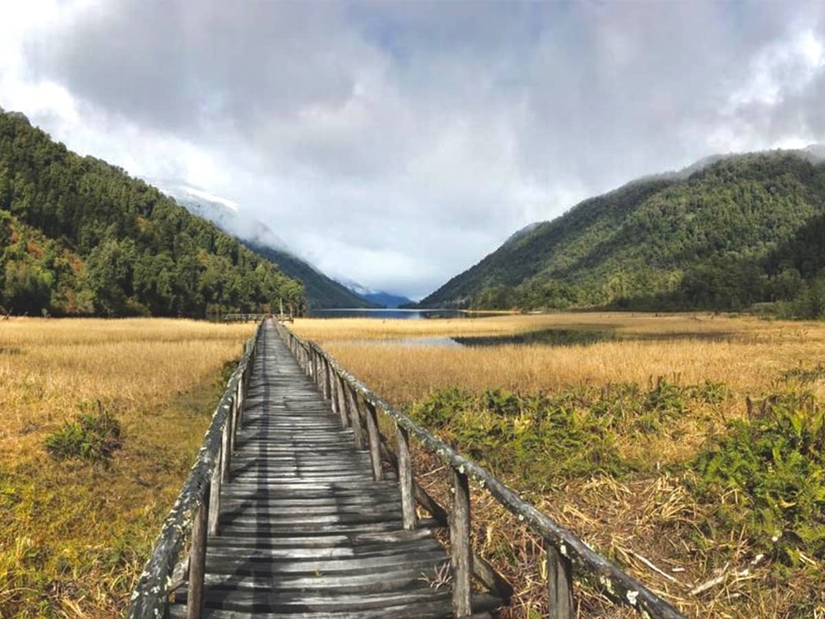
Made famous when Prince William of the British Royal family spent a few months of his gap year working here, Caleta Tortel is an incredibly small settlement with simple buildings of natural timber construction set upon wooden stilts on the hill sides. There are no roads or streets in the usual sense, but a series of interconnected wooden boardwalks between houses and areas. The combined length of all the boardwalks is 7km.

The village is located between the Northern and Southern Patagonian icefields that cover the Andes. This combined area of snow, ice and glaciers covers around 4,000k2 of mountain tops. Here, is also the place where Chile’s most powerful river, the River Baker, enters into Pacific waters together with the rivers of the Bravo, Pascua and Huemules, which, together create a network of channels and inland waterways containing glacial-melt, fresh water.

Historically, the Kawesquar, indigenous people occupied this area, using their canoes carved from tree trunks to navigate the channels, fiords and islands in Southern Patagonia. This is not lost on the people of Caleta Tortel and there are many wood-carved sculptures of the Kawesquar people and their canoes at various places, especially the plazas, around the village.

The village was officially founded in 1955 and was only accessible by water until 2003. However, these days the Carretera Austral Road has arrived to Tortel and access is also by vehicle.

It can be considered a “quaint” village, or to some, a rather “backward” settlement where locals appear to have no concern for the local environment, often throwing waste literally “out of the window”.

However, it is totally unique and for this reason it merits a visit and is also a good logistical stop off.

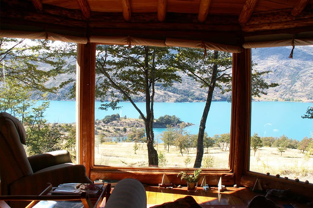
The location of the village, beside the mouth of the River Baker and in a forested-sided fiord, makes for pretty surroundings. If you stay for a couple of days, it is possible to visit Jorge Montt Glacier, the “Isla de los Muertos”, Steffen Glacier and trek the La Bandera Hill.

Car Park

Visitors must park their cars in the car park located at the entrance to the village and from here you will need to walk to your hotel, which can be up to 2km. Therefore, any guests staying overnight need to take only a small bag with you to your accommodation and not try to carry or pull any suitcases with you.

Note: ExperienceChile.Org will create a custom-made travel itinerary to your specifications. Just let us know.

Valle Chacabuco, Patagonia National Park, Carretera Austral, Patagonia, Chile

Valle Chacabuco, Patagonia National Park, Patagonia, Chile

Introduction

This valley entrance is approximately 38km south of Puerto Guadal and is within the Patagonia National Park. It is accessed by turning left, where sign posed, about 24km before entering Cochrane (Cochrane is 62km south of Puerto Guadal).

The Park covers an area of 304,527 sq2 hectares and was declared a National Park in October 2018. Like Pumalin National Park, this area was donated to the Chilean state by the Thompkins Conservation Foundation, in 2017. Its aim is to protect and preserve ecosystems within central Patagonia as well as endangered wildlife populations such as “Huemul” and the Puma. These efforts have been applauded internationally as an example of how to preserve grasslands and reintroduce key animal and plant species.

There is one place to stay if visiting, which we detail below, and from here you can trek on stipulated trails as well as view Tehuelche cave art dating back 7,000 years. The hotel is built, decorated, and furnished to very high standards and provides an excellent base from where to venture out into the wild and rugged terrain of raw Patagonia.

Parque Nacional Patagonia (Valle Chacabuco)

Access: Valle Chacabuco (north of Cochrane)

Vast valleys sculpted by the Chacabuco River form a natural corridor that, since ancient times, has been used for travel both by nomadic peoples and a large diversity of fauna. Once the site of big cattle ranches, today the grasslands have begun to recover after a century of overgrazing and are now home to one of the highest levels of biodiversity in the Aysén region.

This is Patagonian steppe in all its splendour––mountain ranges, Lenga and Ñirre forests that burst with red in fall, active wildlife, and dozens of spectacular lagoons and lakes, such as Cochrane and Jeinimeni, which nourish these landscapes of overwhelming beauty. All this helps to tell the story of one of the most important ecosystem restoration projects in the country.

  • Open: Year-round
  • Area: 752.502 acres
  • Climate: Cold steppe and trans-Andean continentalRainfall: 8 inches annually
  • Ecosystem: Patagonian steppe, deciduous forest, wetlands, high mountain
  • Founded: December 11, 2018
Suggested Places of Interest and/or Activities
  • Drive the scenic Route X-83 toward Roballos Pass.
  • Hike the Lagunas Altas Trail in the Chacabuco Valley.
  • Take in the vastness of Lake Cochrane from the Douglas Tompkins Lookout Point or from one of the Tamango trails.
  • Visit the confluence of the Baker River––the river with the largest water volume in Chile––and the Chacabuco River.
  • Cross the 330-foot-long footbridge over the Chacabuco River and the footbridge found in the Avilés Valley.
  • Birdwatch at the various lagoons in the Chacabuco Valley.
  • Walk through the Lenga forests in fall.
  • Take a boat along the Cochrane River.
  • Apreciar la belleza del Lago Jeinimeni (Km. 65, Ruta X-753)
  • Visit the “Piedra Clavada”-  a 130-foot-tall volcanic rock formation, and the Moon Valley in Jeinimeni (Route X-753, mile 15 / kilometer 25).

Note: ExperienceChile.Org will create a custom-made travel itinerary to your specifications. Just let us know.

Partner Hotels Valle Chacabuco

Lake General Carrera, Carretera Austral, Patagonia, Chile

Lake General Carrera, Carretera Austral, Patagonia, Chile

Introduction

Lake General Carrera, located 356km south of Coyhaique, is the largest lake in Chile which also crosses into Argentina, whereupon it becomes known as Lake Buenos Aires.

On its south-eastern shore is the village of Chile Chico; on its north-west shore is the Puerto Rio Tranquilo (from where the boats depart to see the marble caves); and around its south-western sector is the village of Puerto Guadal. It is around here where most of the accommodation is located.

Puerto Guadal

Puerto Guadal is a small village located beside an inlet on the south-western shore of Lake General Carrera, 115km directly west from Chile Chico.

The geography on the way to this part of the Carretara Austral, that is to say between Villa Cerro Castillo to Puerto Guadal, is “typical” Patagonia. For example, jagged mountain peaks interspersed with glaciers and snow coverings, cascading waterfalls, forested valley sides, meandering rivers, remnants of forests devastated by volcanic eruptions and, in places, turquoise-coloured lakes and rivers.

What’s Here?

In this area are opportunities to trek into the past and discover millennial fossils, trek atop of glaciers (with guides and proper equipment), go up rivers and creeks in a high-speed jet boat, fly fish on the Baker River, lakes and rivers, visit the natural marble “cathedral” caves at Puerto Rio Tranquilo, or just relax and take in the tranquillity of the remoteness.

This is definitely an area that merits a stop off for a few nights if you really want to enjoy what is on offer here.

Note: ExperienceChile.Org will create a custom-made travel itinerary to your specifications. Just let us know.

Accommodation Carretera Austral, Aysen, Sector 2, Patagonia

Carretera Austral Jetty Lago General Carrera Experience Chile
Carretera Austral View To Tres Lagos Experience Chile

Introduction

The accommodation styles in the Aysen Region of Chile, where the southern sector of the Carretera Austral passes through varies from hotel to lodge, rustic lodge and luxury lodge.

Here at Experience Chile, we try to know, first-hand, as many accommodation options as possible.

We do not, and cannot, depend on what is published in the internet because property feels that they are “the best”, which often, is just not the case.

We carry out regular inspection visits with a view to knowing what the accommodation on offer is really like. In many situations we stay overnight in order to get as good idea as possible about what it is like to stay overnight in a particular hotel, lodge or cabin.

You will see in this accommodation section that we have divided the accommodation options in a way that we feel best categorises each accommodation option. In addition we have stipulated if the property has been “inspected” and / or “approved” by us. If a hotel has not been inspected, it means only that. If a place has not received our “approved” label it just means that we do not feel we cannot “overly recommend” that place, but it may be perfectly good.

NOTE: You may well have a particular hotel, or lodge, that is not shown in our listings. If this is the case, PLEASE tell us what and where this hotel is, and we will include it in your itinerary.

Good Level Hotels

We define a “good level” hotel as being a place that does not merit, yet, being in the luxury nor “top, or high end” level of accommodation. Good level means a perfectly decent, comfortable hotel.

Mid Level Hotels

Our “mid level” category is a hotel that could be better, but is not bad either. Usually these properties are “practical” more than providing any particular characteristic that would push it into a higher category. Therefore it is in-between good and “could be better” ie “mid level”, but nevertheless will provide acceptable accommodation.

Self-Drive the Carretera Austral, Puerto Montt to Coyhaique, Patagonia

Self-Drive the Carretera Austral, Puerto Montt to Coyhaique, Patagonia

Carretera Austral, Self-Drive, North to South, Puyuhuapi to Coyhaique

Introduction

This sector covers the sector between La Junta, or Puyuhuapi, or Queulat down to Coyhaique, which is our Stage C.

It goes without saying that here at ExperienceChile.Org we will arrange the rent a car you will need to drive through the Patagonian forest and Andean valleys, as well as your accommodation.

Route Option 1 Puyuhuapi to Puerto Chacabuco:

Total: 204km

Puyuhuapi Puyuhuapi Lodge C Park National Park Queulat Villa Amengual Villa Mañihuales Puerto Aysen Puerto Chacabuco

Route Description

Puyuhuapi to Queulat National Park - 21km from the village, or 8km from Puyuhuapi Lodge car park.

Upon departing from Puyuhuapi, and when you are back on the main Carretera Austral Road, again heading south, the entrance to Queulat National park will be on your left. This will be 21km south of Puyuhuapi village or 8km south from the Puyuhuapi Lodge car park.

The National Park Queulat is one for the main attractions in this area because it contains an impressive hanging glacier. The best way to see this is to be staying in the area and do a full day excursion into the Park.

Puerto Cisnes (Optional Detour)

From Puyuhuapi village the road will continue south for about 83km to a turn off where there will be a sign RIGHT to Puerto Cisnes.

Puerto Cisnes is a small fishing village located 35km from this turn off, on the western coast of Patagonian Chile. It is a non-descript place, but if you seek to see some real life that is NOT made for the tourists then this place will give you that option. Basic accommodations and very rustic. However, it is also the embarkation point to go over and see the Parque Nacional Isla Magdalena.

Ignoring Puerto Cisnes

On to Coyhaique (with Puerto Chacabuco Option)

Ignoring the turn right to Puerto Cisnes, continue onward to Villa Amengual (34km from the turn off to Puerto Cisnes), on a paved road, and then a further 40km on paved road will bring you the main junction that meets the road to Coyhaique (turn left) and Puerto Aysen (turn right). If you want to get to Puerto Chacabuco for the catamaran to see Glacier San Rafael, you need to turn right to Puerto Aysen.

Puerto Chacabuco is also about 14km south from Puerto Aysen. Considering its geographical location, at the eastern end of the Aysen fiord, it is well protected from the natural elements.

Glacier San Rafael Catamaran Navigation

It is the place from where the catamaran operates to take people to see the large San Rafael Glacier.

The navigation tales around 5hrs by catamaran (or few a days by boat from Puerto Montt, see our Patagonia Cruises, Crucero Skorpios itinerary). To fly over the glacier takes 1hr 30min by light aircraft from Coyhaique, Balmaceda airport.

The National Park, called Parque Nacional Laguna San Rafael, covers an area of 1,742,000 hectares and includes the Glacier San Rafael which, as it slowly recedes back from the sea, breaks off into huge icebergs that float in the San Rafael Lagoon. The size of the glacial wall and the massive chunks that break off draws travellers from all over the world. All boats pass between the archipelago channels and passengers can enjoy a beautiful scenic journey going to and returning from the glacier.

Route Option 2 Puyuhuapi to Coyhaique Direct

Total: 209km

Puyuhuapi Puyuhuapi Lodge C Park National Park Queulat Villa Amengual Villa Mañihuales Coyhaique

Route Description

The route from Puyuhuapi is the same up to the turn off that takes you to Puerto Cisnes. Therefore, we will start from this turn off for the trip direct down to Coyhaique.

Ignoring the turn right to Puerto Cisnes, continue onward to Villa Amengual (34km from the turn off to Puerto Cisnes), on a paved road, and then a further 40km on paved road will bring you the main junction that meets the road to Coyhaique. To get to Coyhaique turn left and 70km later you will arrive there.

Coyhaique

This is the principal city of this region and offers itself as a base from which to explore this incredible zone. It is also the only city with an airport with connections to Puerto Montt (and sometimes with Punta Arenas), although the actual airport is called Balmaceda and is about 50km from Coyhaique.

The scenery around Coyhaiqe is like that the Mid-Western USA. Enormous mountainous ridges as well as plains. It has a “cowboy” feel to the place and, indeed it is a Chilean “cowboy” town in the heart of Patagonia.

If you are only covering the northern part of the Carretera Austral Coyhaique will be the end destination. However, if you have arrived to Coyhaique or just extending your trip then from here you will head further south.

Carretera Austral, Self-Drive, North to South, Caleta Gonzalo to Puyuhuapi, with Optional Futaleufu

Introduction

What follows is a brief description for driving Sector 1, Stage B of the Carretera Austral, Puerto Montt or Puerto Varas down to Coyhaique.

It goes without saying that here at ExperienceChile.Org we will arrange the rent a car you will need to drive through the Patagonian forest and Andean valleys, as well as your accommodation.

Route Option 1:

Caleta Gonzalo to Futaleufu

Total: 216km

Caleta Gonzalo Chaiten Santa Lucia Futaleufu

Futaleufu to Puyuhuapi

Total: 200km

Futaleufu Santa Lucia La Junta El Pangue Puyuhuapi Village

Route Description

The first part is Caleta Gonzalo to El Chaiten, which is 60km. Initially the road is unpaved, passing through native forests full of birds. Towards the end of the unpaved part the road becomes paved, passing close to the coast where the steep-sided hills come down to black, volcanic-sand beaches and where, also, the forest comes down to the water’s edge.

El Chaiten is where you can fill up with fuel for the car and maybe rest and have some food. The village used to be a good stop over place, however, in 2008 a nearby volcanic eruption caused a mud slide that wiped out one part of the village and the residents were told to evacuate. Today some residents returned and there are minimal services. The evidence of the ash mud slide covering buildings is still viewable today.

It is also the entrance point to get to Parque Nacional Corcovado.

El Chaiten to Villa Santa Lucia

Total: 78km

Route Description

The initial sector is 44km on a good, paved road. It passes by Chaiten airport (only for light aircraft) and continues through native forest until you get to a bright orange bridge that crosses over the River Yelcho. On the left is Lake Yelcho and on the right is the river. Once over the other side the road is still paved but shortly will change to unpaved for 35km until arrival to Villa Santa Lucia.

Villa Santa Lucia to Futaleufu

Total: 78km

Route Description

Villa Santa Lucia is a tiny settlement, which after considerable heavy rainfall, suffered a landslide to its most northern-located buildings in 2016. In reality, just before coming to the village of Santa Lucia the road you will be on is split between carrying on to La Junta or turning left to Futaleufu.

In this scenario you will take the left turn to Futaleufu. The road will be unpaved for 19km to Puerto Ramirez. During this route you will see Lake Yelcho on the left and the forested hills either side. From Puerto Ramirez the road will continue unpaved for 59km until you arrive to Futaleufu. However, once past the end of Lake Yelcho the road will start to climb and will continue to do so until you arrive at Futaleufu.

Futaleufu Places of Interest

Futaleufu is very close to the Argentine border, and about 250km north from Coyhaique and approx 80km directly east from Chaiten this is a small village nestled in a valley surrounded by mountains. It is a “Mecca” for white-water rafting enthusiasts because it is the access point for the Futaleufu river, offering one of the wildest rafting experiences on Earth. It is also a great place for fly-fishing and generally relaxing amid a vast area of undisturbed natural beauty.

Futaleufu to La Junta, or Raul Marin Balmaceda, or Puyuhuapi is explained further below, from Santa Lucia. Therefore, after Futaleufu you will need to drive back the 78km to Santa Lucia and turn LEFT on to the Carretera Austral heading south towards La Junta.

Route Option 2:

Caleta Gonzalo to La Junta

Total: 214km

Villa Santa Lucia to La Junta

Total: 76km

Caleta Gonzalo Chaiten Santa Lucia La Junta

Route Description

Villa Santa Lucia is a tiny settlement, which suffered a landslide to its most northern-located buildings in 2016 after considerable heavy rainfall. The main Carretera Austral Road by-passes Villa Santa Lucia, leaving the small settlement to the left. Therefore, you just continue straight ahead on the one road for 76km to La Junta. The sector about 10km or so before arriving to La Junta is paved road.

Route Option 3:

Caleta Gonzalo to Puerto Raul Marin Balmaceda

Total: 292km

Villa Santa Lucia Puerto Raul Marin

Total: 154km

Caleta Gonzalo Chaiten Santa Lucia Raul Marin Balmaceda

Route Description

Villa Santa Lucia is a tiny settlement, which suffered a landslide to its most northern-located buildings in 2016 after considerable heavy rainfall. The main Carretera Austral Road by-passes Villa Santa Lucia, leaving the small settlement to the left. Therefore, you just continue straight ahead on the one road for 76km to La Junta. The sector about 10km or so before arriving to La Junta is paved road.

However, before arriving to La Junta you will cross over an orange-coloured, modern bridge that crosses over the “Rio Palena”. Almost immediately after crosses this bridge there will be a sign directing you RIGHT to Puerto Raul Marin. From this turn off it will be about 73km to Puerto Raul Marin on an unpaved road.

Puerto Raul Marin Balmaceda Places of Interest

This is a tiny village located on the western side of the Patagonian coast. This is a place to come and feel totally cut off from the rest of the world. We have accommodation here that will let you relax and unwind totally. Sounds of nature, greenery, trees, the sea, river, it’s all here plus fishing, kayaking, walking.

This is also the entry point to get over to Parque Nacional Melimoyu.

Route Option 4:

Caleta Gonzalo to Puyuhuapi

Total: 260km

Caleta Gonzalo Chaiten Santa Lucia La Junta El Pangue Puyuhuapi Village

Route Description

Villa Santa Lucia is a tiny settlement, which suffered a landslide to its most northern-located buildings in 2016 after considerable heavy rainfall. The main Carretera Austral Road by-passes Villa Santa Lucia, leaving the small settlement to the left. Therefore, you just continue straight ahead on the one road for 76km to La Junta. The sector about 10km or so before arriving to La Junta is paved road.

La Junta to El Pangue

Total: 28km

Route Description

Follow the Carretera Austral south and 28km later you will see the entrance to El Pangue on the left, 18km prior to arrival to Puyuhuapi. El Pangue is a rustic lodge in a beautiful setting offering tranquillity amid the forest, beside a lake and river.

El Pangue to Puyuhuapi Village

Total: 18km

Route Description

This is a tiny village set at the end of a fiord. At the village itself there is not much going on, but we would suggest a few nights at the wonderful Termas de Puyuhuapi Hotel and Spa, in order to relax in comfort and participate in local excursions, as well as bath in natural hot-spring indoor pools.

There is fishing, kayaking, walking, and relaxing to be done.

Carretera Austral, Self-Drive, North to South, Puerto Montt or Puerto Varas to Caleta Gonzalo

Introduction

What follows is a brief description for driving the first part of Sector 1, Stage A of the Carretera Austral.

It goes without saying that here at ExperienceChile.Org we will arrange the rent a car you will need to drive through the Patagonian forest and Andean valleys, as well as your accommodation.

First Leg: Puerto Montt or Puerto Varas to Puelche

Route Option 1 Puerto Montt to Puelche:

Total: 45km plus 1 Ferry of 30mins

Puerto Montt La Arena

Route Description

This sector is quite straightforward. You take the paved road, the Carretera Austral Ruta 7, south from Puerto Montt to La Arena. It is a 45 km trip bordering the coast with the sea on your right.

At the start of your journey, you will see in the distance, in front and to your left, an impressive horizon of high mountain peaks, which is basically the southern part of the Andes Mountain chain. This is where you are headed as you drive down the Carretera Austral, navigating the valleys, channels and fiords in between the mountains you are looking at.

Route Option 2 Puerto Varas (located 22km north of Puerto Montt) to Puelche

Total: 166km

Puerto Varas Ensenada Ralun Ensenada Cochomo Puelo Puelche

Route Description

If you are not already at Puerto Varas then you can drive the short 22km north from Puerto Montt and you will be there.

Out of Puerto Varas village follow the southern side of Lake Llanquihue (pronounced yan-kee-way) to Ensenada for 50km (paved road). Along this route you will see the lake on your left and the high, perfectly conically-formed, snow-capped Osorno volcano at the far end. At Ensenada you follow the signs to Ralun (33km on paved road). This route passes through native forest and is very pretty.

At Ralun you continue on the southern side of the long and narrow Estuary de Reloncavi to Cochomo (15km paved road). From Cochomo follow the route to Puelo (32km unpaved road). After Puelo it is then 36km on an unpaved road to Caleta Puelche. Total distance from Puerto Varas to Puelche is 166km, so this will take around 3hrs or so and longer if you stop of pictures and any walk abouts.

If taking option 2 you will benefit from seeing very picturesque scenery, but it will take a lot longer than option 1.

Second Leg: From Puelche to Hornopiren 55km

Puelche to Hornopiren

Total: 55km

Puelche Hornopiren

Route Description

Initially the road from Caleta Puelche is paved and then it changes to unpaved. The road distance to Hornopiren is 55km. We suggest Hornopiren as a first night after Puerto Montt or Puerto Varas to stop off and rest. The village is tiny and is set beside a small channel with forested hills behind.

Third Leg: Hornopiren to Caleta Gonzalo (Parque Pumalin)

Hornopiren to Caleta Gonzalo (Parque Pumalin)

Total: 5hrs with ferry crossings considered plus a 10km drive.

Note: Please check ferry departure times because they are subject to change without notice. Also get to the ferry ramp early because there is a limit to the number of cars allowed on the ferry.

Hornopiren (Ferry 4hrs) Leptepu (10km) Fiordo Lago (Ferry 45mins) Caleta Gonzalo

Route Description

The first part of this route is on the ferry from Hornopiren to Leptepu, which will take around 4hrs. Departures at 10:30hrs and later at 12:00hrs per day. The scenery along this navigation is of forested hill sides and inlets.

The next part is a short drive from Leptepu to Fiordo Largo, which is 10km on an unpaved road and through a forest. At Fiordo Largo you take another ferry to Caleta Gonzalo, which will take around 45mins.

Departures are at 14:45hrs, at 15:35hrs, at 16:45hrs and 17:30hrs during the high season (but check prior to departure).

Upon arrival to Caleta Gonzalo you drive up a steep, but short ramp and approximately 200mt on the right are the cabins of Pumalin where we will book you for a couple of nights. From here you can get into the millennial Alerce forest, within the Parque Nacional Pumalin, the next day.

Places of Interest and Activities, Between Puerto Montt and Coyhaique, Carretera Austral, Patagonia

North to South Maine Places of Interest & Activities

Note: Our Sector 3 South to North is the Sector 1 in reverse order. Therefore, we are not showing Sector 3 below.

Parque Pumalin (Millennial Alerce Trees)

Click on map for larger image

Where? Caleta Gonzalo

The Pumalin National park was one of the first in Chilean Patagonia to be created by Douglas and Kristine Tompkins and then gifted to the Chilean nation. It contains vast areas of native forest including Alerce trees that date back thousands of years.

White Water Rafting and River Kayaking

Click on map for larger image

Where? Futaleufu

The Futaleufu river is known to be one of the best in the World for white-water rafting. It has high-grade challenging rapids for those who seek the adrenalin rush, as well as less difficult for the rest.

Puyuhuapi Hot Springs

Click on map for larger image

Where? Puyuhuapi Lodge

Along the Carretera Austral there are a few places where water has been heated by underground volcanic heat and then surfaces to ground level. Such locations are called “hot springs”.

However, one particular place has mastered access to this natural heated water in one of the remotest places on the Carretera Austral and built a high-quality lodge here. The ability to bathe in the hot springs and enjoy total comfort in a tranquil, beautiful location is excellent for anyone’s health.

Queulat Hanging Glacier

Click on map for larger image

Where? In Queulat National Park

The glacier is high up in the Queulat National Park, just south of Puyuhuapi. It is a large glacier to see at height and in one sector there is a waterfall caused by the melting ice and this cascades down from the height of the glacier to the lagoon below.

Laguna San Rafael Glacier

Click on map for larger image

Where? From Puerto Chacabuco

The San Rafael Glacier is a large glacier that comes down from the northern ice field that covers the Andes. Navigational trips depart from Puerto Chacabuco (79km west from Coyhaique) to see the high and wide glacial ice face calve off into a sea-water lagoon.

Fly Fishing

Click on map for larger image

Where from? See below...

Patagonia is one of the World’s greatest places for fly fishing. This is due to the vast number of rivers, lakes and lagoons and the fact that this area is still relatively new in terms of numbers of people coming here to fish.

There are large fish to be caught, usually under catch and release. Among the varieties are Rainbow, Brown and Brook trout, as well as Atlantic salmon (these have come out from Chilean agua programs), Coho salmon and Chinook salmon.

Above are a few of the principal destination places where you can fly fish. However, there are also numerous other lodges spread around Patagonia in remote locations. If you are a serious fly-fisherman and seek such lodges, please get in touch and we will arrange whatever you need.

Destinations to Fly Fish from:

Lago Yelcho via Futaleufu La Junta Melimoyu Lodge El Pangue

Parque Nacional Isla Magdalena, Carretera Austral, Patagonia, Chile

Parque Nacional Isla Magdalena, Carretera Austral, Patagonia, Chile

Introduction

Access: From Puerto Cisnes (by boat only)

Isla Magdalena’s rugged landscapes, deep ravines, and coastal bluffs make it an ideal environment for species such as Penguins, Cormorants, Sea Lions, and Huillines (Southern River Otters).

Situated between the Chilean continent and the Guaitecas Archipelago, in Río Cisnes, Isla Magdalena is one of the largest islands to the south of Chiloé. 80% of its surface is protected land. At the center of the island, the peak of Mentolat Volcano stretches 5,446 feet above sea level amongst the exuberant flora of the northern Patagonia cordillera.

Brief details
  • Open: Only sea access
  • Area: 617,052 acres
  • Climate: Rainy and mild
  • Rainfall: 157 inches annually
  • Ecosystem: Evergreen Chono Forest
  • Founded: July 11, 1983
Suggested Places of Interest and / or Activities
  • Schedule a trip in boat with local guides to spot and learn about a huge diversity of marine life.
  • Circumnavigate the island in sea kayak.
  • View Mentolat Volcano (5446 feet above sea level) and, for more seasoned hikers, plan an ascent to its peak.
  • Visit Puerto Gaviota, a fisherman’s cove at the southern edge of the island.
  • Visit the Santa Isabel and San Andrés islets to get a closer look at the sea lions.

Note: ExperienceChile.Org will create a custom-made travel itinerary to your specifications. Just let us know.

Parque Nacional Melimoyu, Carretera Austral, Patagonia, Chile

Parque Nacional Melimoyu, Carretera Austral, Patagonia, Chile

Introduction

Access: From Puerto Raul Marin Balmaceda (sea navigation required)

Along Melimoyu’s coasts, the Blue Whales are the protagonists. It’s estimated that 10% of the world’s population of cetaceans migrate to the Corcovado Gulf during the Southern Hemisphere summer to feed on Krill.

Dozens of rivers flow from the area’s glaciers into its channels and fjords, bringing organic material from the forests and bogs and giving life to an aquatic ecosystem rich with biodiversity where an abundance of wildlife makes its home.

This pristine habitat in Cisnes features incredible landscapes dominated by the imposing Melimoyu Volcano (which means “four pieces” in Mapudungún). It was once considered to be a possible entry point to the mythical, and perhaps enchanted, City of the Caesars.

Brief details
  • Open: Not currently open to the public
  • Area: 258,223 acres
  • Climate: Rainy and Temperate
  • Rainfall: 113 inches annually
  • Ecosystem: Evergreen Forest and Patagonian Subantarctic Forest
  • Founded: In process
Suggested Places of Interest and / or Activities
  • See the Melimoyu Volcano (7,874 feet above sea level).
  • Explore the channels and fjords in February and March, looking out for Blue Whales and other species such as Orcas, Humpback Whales, Chilean Dolphins, and Peale’s Dolphins.
  • Spend time in the forest trying to spot endangered species such as the Pudú Deer and Darwin’s Frog.
  • Visit the town of Melimoyu to learn first-hand about the last wave of settlers in Chile.

Note: ExperienceChile.Org will create a custom-made travel itinerary to your specifications. Just let us know.

Parque Nacional Queulat, Carretera Austral, Patagonia, Chile

Parque Nacional Queulat, Carretera Austral, Patagonia, Chile

Introduction

Access: Queulat (south of Puyuhuapi)

Queulat means “Sound of Waterfalls” in the Chono people’s language. This park was first seen in the eighteenth century by Jesuits searching for the mythical City of the Caesars. Today, Queulat National Park, near Puyuhuapi, is admired by thousands of visitors each year, who are attracted by its beautiful evergreen and Andean Patagonian forests, its waterfalls, fjords, jagged rock walls, abundant rivers, and famous hanging glacier or “Ventisquero Colgante”, which can be spotted from the Carretera Austral.

Brief details
  • Open: Year-Round
  • Area: 380,772 acres
  • Climate: Cold temperate climate, with no dry season
  • Rainfall: 135–160 inches annually
  • Ecosystem: Temperate Rainforest and High-Mountain Deciduous Shrubland
  • Founded: October 13, 1983
Suggested Places of Interest and / or Activities
  • The hanging glacier, is the most emblematic feature of the park.
  • Cross the Ventisquero River footbridge.
  • Visit the Los Témpanos and Los Pumas Lagoons. In the summer, you can also explore Los Témpanos in boat.
  • Visit the Padre García Waterfall, which is around 100 feet tall.
  • Explore Lake Risopatrón, located near Puyuhuapi, along the route.
  • Enjoy the 33 curves of the Queulat slope, winding up to the pass.

Note: ExperienceChile.Org will create a custom-made travel itinerary to your specifications. Just let us know.

Parque Nacional Corcovado, Carretera Austral, Patagonia, Chile

Parque Nacional Corcovado, Carretera Austral, Patagonia, Chile

Introduction

Access: Chaiten

The magnificent Corcovado Volcano stands 7,546 feet above sea level, welcoming visitors to this difficult-to-access, pristine ecosystem of evergreen forests, fjords, bays, rivers, deep valleys, and dozens of hidden lakes.

The park was created thanks to Tompkins Conservation’s generous donation of more than 207,570 acres and to the incorporation of national parklands. It features vast expanses of untouched, unexplored land, including hidden corners of the Corcovado Golf and Tic Toc Bay, in Chaitén.

Brief details
  • Open: Not currently open to the public
  • Area: 988,450 acres
  • Climate: Rainy and mild
  • Rainfall: 110 inches annually
  • Ecosystem: Temperate Rainforest and Deciduous High-Mountain Shrubland
  • Founded: January 7, 2005
Suggested Places of Interest and / or Activities
  • Corcovado Volcano (7,546 feet above sea level), which can be viewed from Chaitén.
  • Sail or row in Tic Toc Bay and visit the river of the same name.
  • Fish in Corcovado River.
  • Nevado Volcano (6700 feet above sea level), also known as Yantenes or Yanteles Volcano.
  • Lake Trébol.
  • Visit to the Yelcho Snowdrift (in November, maintenance activities will begin, which will not cause visitors inconvenience).

Note: ExperienceChile.Org will create a custom-made travel itinerary to your specifications. Just let us know.

Parque Nacional Pumalin, Carretera Austral, Patagonia, Chile

Parque Nacional Pumalin, Carretera Austral, Patagonia, Chile

Introduction

Access: Caleta Gonzalo

The deep forests of Pumalín reach all the way to the fjords, creating one of the most spectacular coastlines on the planet. Hundreds of waterfalls cascade down from glaciers, falling over steep granite walls, as the Michinmahuida and Chaitén. Volcanoes crown the landscape.

The park’s most notable feature is the threatened Alerce (Fitzroya) tree––25 percent of Chile’s remaining Alerces can be found in this National Park. These ancient trees’ 3,000 years of life help to tell a timeless story of this pristine ecosystem, tucked in the Palena Province.

Brief details
  • Open: Year-round
  • Area: 994,332 acres
  • Climate: Temperate Rainforest
  • Rainfall: 235 inches annually
  • Ecosystem: Rainy and mild
  • Founded: February 28, 2018
Suggested Places of Interest and / or Activities
  • Many trekking trails (see below).
  • Explore the Reñihué and Comau Fjords.
  • Look for marine life from Caleta Gonzalo.
  • Hike up the Chaitén Volcano, which erupted in 2008.
  • Visit the glacier found on the Michinmahuida Volcano, via the Michinmahuida Trail or Ventisquero Trail.
  • Walk through the forests of Alerces (Los Alerces Trail).

Note: ExperienceChile.Org will create a custom-made travel itinerary to your specifications. Just let us know.

Partner Hotels Caleta Gonzalo

Parque Nacional Hornopiren, Carretera Austral, Patagonia, Chile

Parque Nacional Hornopiren, Carretera Austral, Patagonia, Chile

Introduction

Access: Hornopiren

Hornopirén National Park, (means “snow oven” in Mapudungún), forms part of the regional ecosystem of evergreen temperate rainforests. It is known for its rich biodiversity, high levels of endemic species, and thousands-of-years-old trees. This park is part of the World Biosphere Reserve of Temperate Rainforests of the Austral Andes. It features nearly 22,240 acres of Alerce trees.

The Hornopirén Volcano, although not within park limits, crowns this landscape of mountain valleys sculpted by snowdrifts, lakes, lagoons, and rivers such as the Puelo Chico, the Ventisquero, and the Blanco, which flows into the Comau Fjord, in Huailahué.

Brief details
  • Open: Year-Round (We recommend visiting between November – March)
  • Area: 170,985 acres
  • Climate: Rainy and mild
  • Rainfall: 89 inches annually
  • Ecosystem: Temperate Rainforest
  • Founded: October 19, 1988
Suggested Places of Interest and / or Activities
  • Walk to Lake Pinto Concha
  • Visit the Río Blanco Waterfall.
  • Explore the evergreen forest of Alerce, Tepa, Ulmo, and Luma trees, among other species
  • Hornopirén Volcano, with a peak of 5157 feet above sea level
  • Yates Volcano, with a peak of 6926 feet above sea level.

Note: ExperienceChile.Org will create a custom-made travel itinerary to your specifications. Just let us know.

Parque Nacional Alerce Andino Carretera Austral, Patagonia, Chile

Parque Nacional Alerce Andino Carretera Austral, Patagonia, Chile

Introduction

Access: Puerto Montt

The trees of Alerce Andino National Park come from an old and storied lineage. This regional ecosystem remained isolated from the glaciers that covered the area 12 thousand years ago.

Today, its forests are a global icon of endemic fauna––one in three species in this forest is not found anywhere else on the planet. Vertical walls of granite surround the park’s fifty or so lagoons, and its rugged geography has long protected millennia-old Alerce (Fitzroya) trees that grow over more than half of the park’s surface. This priceless ecosystem can be found south of Lake Chapo and is classified as a Biosphere.

Brief details
  • Open: Year-Round
  • Area: 97,001 acres
  • Climate: Rainy and mild
  • Rainfall: 157 inches annually
  • Ecosystem: Temperate Rainforest
  • Founded: January 3, 1982
Suggested Places of Interest and / or Activities
  • Visit the ancient Alerce (Fitzroya) trees in the Sargazo sector of the park––which are around 2,500 years old––or in the Las Chaicas sector of the park, where they’re nearly 3,000 years old
  • See the Las Chaicas waterfall
  • Cross the suspension bridge on the Lake Sargazo trail
  • Visit a few of the lakes you can reach via the trail network, such as Sargazo, Chaiquenes, Triángulo, Chilco, Fría, or Gaviota

Note: ExperienceChile.Org will create a custom-made travel itinerary to your specifications. Just let us know.

Carretera Austral, North to South, Sector 1, Puerto Montt to Coyhaique, Patagonia

Introduction

The Sector 1 runs north to south, starting at either Puerto Montt or Puerto Varas and ending at Coyhaique (approx 765km from P Montt or 763km from P Varas).

The route will pass through two provinces, or regions, of Chile. The first part will go through the southern part of the Lake Region and the second part will enter into the Aysen Region.

The Lake Region

Chile’s Lake Region is a stunningly beautiful collection of lakes, snow-capped volcanoes, rivers and green-forested mountain valleys.

Puerto Montt and Puerto Varas, the optional, northern, starting points for the Carretera Austral, are located in the southern edge of the main Lake Region, by the large Lake Llanquihue (pronounced yan-kee-way). The Carretera Austral then passes through a more “rugged” and “less serene” lake region sector. This is because, unlike the main lake region, the ancient valleys have been flooded by sea water tens of thousands of years ago, where those valleys are now fiords. Also, the space that the Carretera occupies is along a narrow strip where either side are steep, forested mountain sides. There are lakes in this sector but spread around and located at varying altitudes. In addition, the rivers tend to be faster flowing and the ice fields on top of the Andes are closer to ground level. The reason for this is because the Andes and snow line are lower in altitude the further south one goes. The snow line decreases in altitude because the overall temperature decreases the further one gets away from the equator.

The Aysen Region

The Aysen province contains more islands, fiords, inlets, rivers, ice fields and waterfalls than the northern Lake Region. This is because as the Carretera Austral continues south it passes through areas that endured more “ice age craftsmanship”, in the sense that more fiords, inlets, channels were “gouged” out in this area. Largely because as the road gets further away from the equator the climate is cooler, snow fall, over the millennia was more plentiful and glaciers were created with more mass.

Below we highlight the main National Parks, places of interests and activities to be found in Sector 1.

The Better-known Places of Interest and Activities IN Sector 1:

Parque Pumalin (Millennial Alerce Trees)

Click on map for larger image

Where? Caleta Gonzalo

The Pumalin National park was one of the first in Chilean Patagonia to be created by Douglas and Kristine Tompkins and then gifted to the Chilean nation. It contains vast areas of native forest including Alerce trees that date back thousands of years.

White Water Rafting and River Kayaking

Click on map for larger image

Where? Futaleufu

The Futaleufu river is known to be one of the best in the World for white-water rafting. It has high-grade challenging rapids for those who seek the adrenalin rush, as well as less difficult for the rest.

Puyuhuapi Hot Springs

Click on map for larger image

Where? Puyuhuapi Lodge

Along the Carretera Austral there are a few places where water has been heated by underground volcanic heat and then surfaces to ground level. Such locations are called “hot springs”.

However, one particular place has mastered access to this natural heated water in one of the remotest places on the Carretera Austral and built a high-quality lodge here. The ability to bathe in the hot springs and enjoy total comfort in a tranquil, beautiful location is excellent for anyone’s health.

Queulat Hanging Glacier

Click on map for larger image

Where? In Queulat National Park

The glacier is high up in the Queulat National Park, just south of Puyuhuapi. It is a large glacier to see at height and in one sector there is a waterfall caused by the melting ice and this cascades down from the height of the glacier to the lagoon below.

Laguna San Rafael Glacier

Click on map for larger image

Where? From Puerto Chacabuco

The San Rafael Glacier is a large glacier that comes down from the northern ice field that covers the Andes. Navigational trips depart from Puerto Chacabuco (79km west from Coyhaique) to see the high and wide glacial ice face calve off into a sea-water lagoon.

Fly Fishing

Click on map for larger image

Where from? See below...

Patagonia is one of the World’s greatest places for fly fishing. This is due to the vast number of rivers, lakes and lagoons and the fact that this area is still relatively new in terms of numbers of people coming here to fish.

There are large fish to be caught, usually under catch and release. Among the varieties are Rainbow, Brown and Brook trout, as well as Atlantic salmon (these have come out from Chilean agua programs), Coho salmon and Chinook salmon.

Above are a few of the principal destination places where you can fly fish. However, there are also numerous other lodges spread around Patagonia in remote locations. If you are a serious fly-fisherman and seek such lodges, please get in touch and we will arrange whatever you need.

Destinations to Fly Fish from:

Lago Yelcho via Futaleufu La Junta Melimoyu Lodge El Pangue

Carretera Austral, Lake Region to Aysen, North to South Destinations, Sector 1

Introduction

The first part, or the northern start point, of the Carretera Austral is at Puerto Montt or Puerto Varas, both of which are in the southern part of the Chilean Lake Region.

The Lake Region (or Provence) extends south to just above La Junta. Once past this “imaginary line” the route enters the Aysen Region.

Destinations in the Lake Region

Puerto Varas Church Experience
Carretera Austral Rio Futaleufu Experience Chile

The Carretera Austral that passes through the southern sector of the Chilean lake region tends to enjoy scenery of snow-covered, conical volcanoes, lakes, green, forested hill sides, fjords and channels.

Destinations in the Aysen Region

The Aysen sector of the Carretera Austral includes one of the largest expanses of channels and fiords on Earth. In a straight line, start to end, it covers 1,000km, however, the total coastline of the numerous islands, inlets and fjords, if measured and added together, would be more than 84,000km.

If you had the patience to count, there are over 5,500 islands in this part of Chilean Patagonia, the vast majority totally uninhabited by man.

This incredible archipelago, fiords and valleys were crafted from numerous ice ages. Constant snow falls created huge glaciers that slowly came down from the mountains carving out the rock as they did so and leaving behind valleys. Think of Antarctica today, with its ice shelf measuring kms in height!

Then, added to this mix was the shifting of the tectonic plates that caused land to go up, but also down; volcanic eruptions, and flooding from the Pacific Ocean into the lower land areas.

Carretera Austral North Of Puyuhuapi Experience Chile
Carretera Austral Navegacion Laguna San Rafael Experience Chile

And, if that was not enough, the receding glaciers and snow melted to form rivers and lakes, together with abundant rain fall creating numerous more rivers all flowing quickly into the sea.

This combination has resulted in, today, a beautiful eco system and dramatic landscape, full of natural richness.

El Pangue, North of Puyuhuapi, Carretera Austral, Patagonia, Chile

El Pangue, North of Puyuhuapi, Carretera Austral, Patagonia, Chile

Introduction

Located: 28km South from La Junta and 18km North of Puyuhuapi village.

The drive from La Junta towards Puyuhuapi cuts through the natural, untouched forested valleys, crossing fast, and slow-moving, meandering rivers and past waterfalls. However, shortly before arriving to Puyuhuapi there is an accommodation option on the left, at a place called El Pangue, for which we have the link below.

This is a quiet “bubble” next to a lake, at the end of which, is the village of Puyuhuapi.

Note: ExperienceChile.Org will create a custom-made travel itinerary to your specifications. Just let us know.

The Sector on the Way to Futaleufu, Patagonia, Chile

The Sector on the Way to Futaleufu, Patagonia, Chile

Introduction

The road out from Chaiten is paved for about 43km until shortly before arriving to the tiny settlement called Santa Lucia. The scenery either side of the drive is one of forested mountain sides, and if you know where to look, hanging glaciers. Just before entering Santa Lucia there is a turn off left that takes you to Futaleufu. This, unpaved road, passes by the south-eastern end of Lake Yelcho, again, cutting through beautiful, natural landscapes.

Note: ExperienceChile.Org will create a custom-made travel itinerary to your specifications. Just let us know.

Partner Hotels “on the way to Futaleufu”

Coyhaique, Carretera Austral,
Patagonia, Chile

Coyhaique, Carretera Austral, Patagonia, Chile

Introduction

Located: 232km South of Puyuhuapi Village (direct)

Coyhaique is a “proper city” in the middle of the Carretera Austral. It has an airport, called Balmaceda, located about 40km south of the city where daily flights come in from Santiago. However, allow a full hour for the drive from Coyhaique centre to the airport, due to curves in the early sector of the road and possibly slow traffic. For the Carretera Austral this is a principal entry and exit point. From here you can go either north or south on the Carretera.

It is very much a “Patagonian” city, where many people connected to cattle and sheep farming. The surrounding scenery is a mixture of dramatic, steep sided cliffs, valley plains, hills, forest as well as areas that resemble moor land in the UK.

In some parts of the city there is more of a feeling that this part of the World resembles the cattle country of the Mid-Western U.S.A.

What’s Here?

The city is located beside the River Simpson, which offers good trout fly-fishing. Nearby are three National Reserves: the Cerro Castillo, the Rio Simpson and the Coyhaique, where there are pumas and deer.  There are trekking trails that pass close to the city, specifically the McKay trail. In the central sector of the city is a plaza where retailers sell ceramics and wool products. Not surprisingly, in a sector not far from the plaza is a “sheep monument” demonstrating the respect the locals have for this animal, as it provides a lot of work and income for the locals.

Note: ExperienceChile.Org will create a custom-made travel itinerary to your specifications. Just let us know.

Puerto Chacabuco, Carretera Austral, Patagonia, Chile

Puerto Raul Marin Balmaceda, Carretera Austral, Patagonia, Chile

Introduction

Located: 218km South from Puyuhuapi and 79km west from Coyhaique.

Puerto Chacabuco is also about 15km south from Puerto Aysen. Considering its geographical location, at the eastern end of the Aysen fiord, it is well protected from the natural elements.

It is the place from where the catamaran operates to take people to see the large San Rafael Glacier.

Brief details
  • Open: Year-round
  • Area: 4,305,683 acres
  • Climate: Rainy and temperate; polar at altitude
  • Rainfall: 120 to 200 inches annually
  • Ecosystem: Evergreen forest, high-mountain forest, and periglacial shrubland
  • Founded: June 17, 1967
Can't Miss
  • Walk across the Exploradores Glacier.
  • Drive Route X-78, which reaches the park 32 miles west of Puerto Tranquilo and offers gorgeous views of forests, rivers, dozens of waterfalls, hanging glaciers, and snowy peaks.
  • Take Route X-78 to Monte San Valentín (12,830 feet above sea level), the highest peak in Patagonia.
  • Cross Laguna San Rafael in boat to see the glacier and observe icefalls.
  • Visit Lake Los Leones, via the valley that shares its name.
  • Parques en la Región de Magallanes

San Rafael Glacier

The San Rafael Glacier comes down from the Northern Ice Field where it breaks off into sizeable icebergs that float in a sea-water lagoon. The glacial face is extremely high and quite wide. The catamaran that navigates from Puerto Chacabuco to the glacier takes a few hours to get to there, then, of course the same time back, therefore it is a long day. Snacks are served on board and once at the glacial face there is a decent amount of close-viewing time permitted. One of the additional benefits from this trip is the slow navigation through the quiet and picturesque channels, passing small and large uninhabited, forested islands.

Parque Nacional Laguna San Rafael

San Rafael’s magnificent landscapes are a mosaic of fjords, channels, islands, inlets, and ice. Declared a Biosphere Reserve, the park is the main port of entry to Chile’s Northern Icefields. The San Rafael Glacier attracts visitors from all over the world, who set out from Puerto Chacabuco or Puerto Tranquilo to admire its vast, untouched horizons and its biodiversity. Charles Darwin, Fitz Roy, and Alberto de Agostini are just a few of the historical figures who have helped spread the word about this wonderful hidden corner of Aysén.

Note: ExperienceChile.Org will create a custom-made travel itinerary to your specifications. Just let us know.

Puerto Cisnes, Carretera Austral, Patagonia, Chile

Puerto Cisnes, Carretera Austral, Patagonia, Chile

Introduction

Puerto Cisnes is a very simple, remote, and small, coastal fishing village. It is located 35km west from the main Carretera Austral. The turn off to Puerto Cisnes is approximately halfway between Puyuhuapi and Coyhaique.

There are two reasons to visit Puerto Cisnes. One is to experience a place that is relatively “cut off” from the active world and the other is to get over to the National Park Isla Magdalena, for which you will need to secure some type of nautical transport.

Brief details
  • Open: Only sea access
  • Area: 617,052 acres
  • Climate: Rainy and mild
  • Rainfall: 157 inches annually
  • Ecosystem: Evergreen Chono Forest
  • Founded: July 11, 1983
Suggestions
  • Schedule a trip in boat with local guides to spot and learn about a huge diversity of marine life.
  • Circumnavigate the island in sea kayak.
  • View Mentolat Volcano (5,446 feet above sea level) and, for more seasoned hikers, plan an ascent to its peak.
  • Visit Puerto Gaviota, a fisherman’s cove at the southern edge of the island.
  • Visit the Santa Isabel and San Andrés islets to get a closer look at the sea lions.

National Park Isla Magdalena

Isla Magdalena’s rugged landscapes, deep ravines, and coastal bluffs make it an ideal environment for species such as Penguins, Cormorants, Sea Lions, and Huillines (Southern River Otters). Situated between the Chilean continent and the Guaitecas Archipelago, in Río Cisnes, Isla Magdalena is one of the largest islands to the south of Chiloé. 80% of its surface is protected land. At the center of the island, the peak of Mentolat Volcano stretches 5,446 feet above sea level amongst the exuberant flora of the northern Patagonia cordillera.

Note: ExperienceChile.Org will create a custom-made travel itinerary to your specifications. Just let us know.